Multi-constellation GNSS high-precision antenna (GPS/GLONASS/BDS/Galileo)
Model:BFGNSSGWX152X68T
Specification:
- Frequency:1170~1290,1559~1605 Mhz
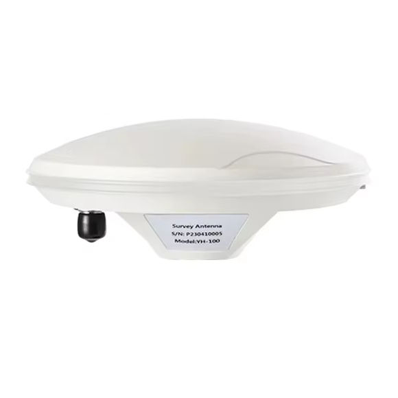
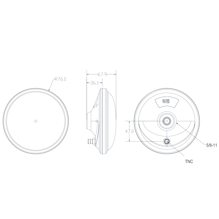
- Size:Φ152 * 67.9 mm
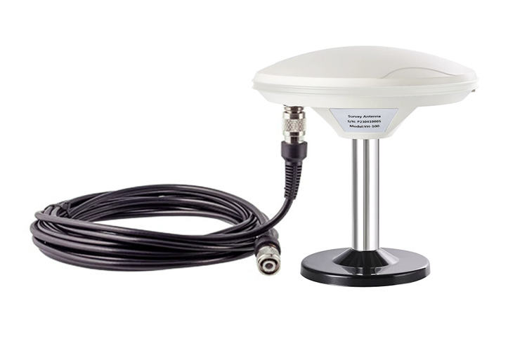
- Connector:TNC ( Female )
About Products


The GNSS High-Precision Antenna (Model: BFGNSSGWX152X68T) is a professional-grade satellite positioning component engineered for high-accuracy positioning scenarios. As a multi-constellation and multi-band antenna, it supports full-band reception of GPS (L1/L2/L5), GLONASS (G1/G2/G3), BDS (B1/B2/B3), and Galileo (E1/E5a/E5b/E6) systems, ensuring stable and precise positioning even in complex environments with limited satellite visibility. Featuring a right-hand circular polarization (RHCP) design, it effectively mitigates multipath interference caused by signal reflection and matches the polarization characteristics of satellite signals, significantly improving positioning accuracy and reliability. Equipped with a TNC female connector and boasting a compact size of Φ152mm×67.9mm, this antenna is ideal for precision surveying, drone navigation, precision agriculture, and geodetic measurement equipment. Fully compliant with RoHS and REACH regulations, it meets global environmental standards for cross-border deployment.
Core Specifications
This GNSS high-precision antenna adopts the model number BFGNSSGWX152X68T, covering all core bands of four mainstream satellite navigation systems: GPS (L1/L2/L5), GLONASS (G1/G2/G3), BDS (B1/B2/B3), and Galileo (E1/E5a/E5b/E6). This multi-band design ensures strong compatibility with global satellite networks, eliminating positioning blind spots caused by single-system limitations. It is fitted with a standard TNC female connector, which offers excellent connection stability and corrosion resistance, suitable for long-term outdoor or industrial use, and is highly compatible with TNC male-equipped high-precision GNSS receivers. The antenna utilizes a right-hand circular polarization pattern, which can effectively suppress multipath interference from terrain, buildings, and other obstacles, ensuring centimeter-level positioning accuracy in demanding scenarios. The product dimensions are Φ152mm×67.9mm, with a rugged, integrated structure that is easy to mount on surveying equipment, drone frames, or fixed monitoring stations. It strictly complies with RoHS and REACH environmental regulations, containing no restricted hazardous substances.
Product Features
- Multi-Constellation & Multi-Band Coverage: Supports GPS, GLONASS, BDS, and Galileo full-band reception, maximizing satellite visibility, and ensuring high-precision positioning in urban canyons, mountainous areas, and other complex environments.
- Right-Hand Circular Polarization (RHCP): Matches the polarization of satellite signals, effectively resisting multipath interference, improving signal-to-noise ratio, and enabling centimeter-level positioning accuracy for professional applications.
- Reliable TNC Female Connector: The TNC interface features a threaded locking design, ensuring a firm connection that resists vibration and loosening, suitable for outdoor surveying and drone operation scenarios with frequent movement.
- Rugged & Compact Design: With a size of Φ152×67.9mm, the integrated structure is lightweight and easy to install, while the durable shell resists wind, rain, and UV radiation, adapting to long-term outdoor use.
- Professional-Grade Positioning Performance: Optimized for high-precision applications, it provides stable positioning data for surveying and mapping, precision agriculture, deformation monitoring, and autonomous driving test equipment.
- Global Environmental Compliance: Fully compliant with RoHS and REACH regulations, meeting the environmental requirements of European, American, and other global markets, facilitating cross-border trade and project deployment.
Application Scenarios
This GNSS high-precision antenna is widely applicable to professional high-accuracy positioning equipment, including but not limited to land surveying and mapping instruments, drone navigation systems, precision agriculture guidance devices, structural deformation monitoring stations, autonomous driving test platforms, and marine surveying equipment. It is especially suitable for scenarios that require centimeter-level positioning accuracy, such as large-scale engineering construction surveying, farmland precision seeding and fertilization, and urban infrastructure deformation monitoring.